Copyright © 2016
By Ralph F. Couey


Winter hikes, generally speaking for me, are spur-of-the-moment events, usually triggered by a restless spirit, a few free hours, and a reflective couple of minutes standing outside, testing the climate. While winter here in Northern Virginia has been pretty mild, except for that one terrible weekend, my required attention to other areas of life kept me out of the woods and off the trail for many of the weeks this year.
The three hikes detailed here were all taken in February and March, with the last one in the first week of April. The days were similar, starting out cold and windy, and ending...well, not warm but certainly less frigid. The first one was an attack on the southern end of the Manassas Battlefield National Park. The trail begins just south of the historic Sudley church and follows an abandoned railroad cut that slices across the park from northeast to southwest. It was originally intended to be a part of the Manassas Gap Railroad, with this 35-mile section connecting Gainesville and Alexandria. This stretch was begun around 1850 and was fully graded when the outbreak of the Civil War required the steel for other purposes. The railroad eventually went broke, but the grading still remains, and can be seen clearly on Google Maps in the terrain mode.


It's a pretty easy hike, a gentle climb up then down while following the path of the grade. On this particular day, however, the difficulty was enhanced by a hard and cold north wind that was blowing in the 20-knot range with higher gusts. While in the lee of the hills, the sun made things almost comfortably warm. But as soon as I moved into the open, the wind returned like a knife. Like most winter hikes, the forest was almost dead silent, save the eerie creaking and moaning of the trees bending in the stiff winds. But there was evidence that despite the dreary brown that dominated the landscape, there were spots of brilliant color, the first of the wildflowers making their appearance.


I went just over 2.5 miles in before turning around and heading back, completing a chilly 5-miler.


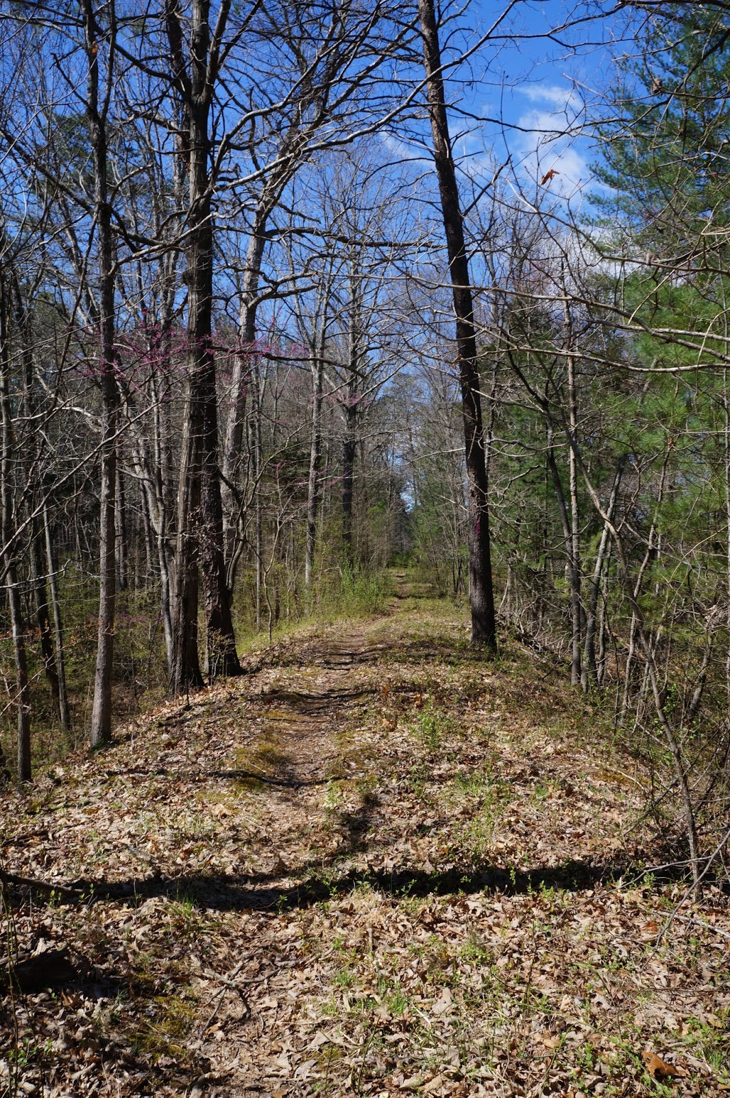
A few miles southwest of the battlefield is a local gem, the Conway Robinson Memorial State Forest. This 444 acre plot is an interesting place. Virginia describes the area as a pine plantation mixed with old-growth hardwoods. The land became a State Forest in February 1938 and was named after Conway Robinson, an author, historian, and lawyer who argued some 100 cases before the U.S. Supreme Court. It was originally half open land and half hardwood trees. The open fields were planted with loblolly and white pine trees and is carefully managed by the state.
The day I chose for this adventure was actually pretty mild, mainly because there was no wind to speak of. There are about 5 miles of trails in the park, but the main trail which circles the perimeter is an easy 3.5 miles. The grade for the abandoned Manassas Gap RR spur which runs through the battlefield, also runs through here. It amazes me that something like this, built with human hands and strong backs still survives almost 170 years later. The hike itself is unremarkable, there being no dramatic overlooks or even any really challenging parts. It is, for all intents and purposes, just a walk in the woods. Still, because it is a forest, it is not without its charms.

Privately owned land next door. Green grass looks good this time of year.

One of my favorites, the aptly-named Spring Beauty.


The wind wasn't howling, but there was enough that it set the pine trees into singing their breathy song.


Just a peaceful place.

A different kind of history book.
Conway Robinson is also a popular place for mountain bikers, but fortunately none were around today.
For the third hike, I went to the Bull Run-Occoquan trail. This 17-miler starts just southeast of the battlefield and follows the eponymous streams down to Fountainhead Regional Park, near Fairfax Station. I usually start at the northern terminus, but this time I decided to start near the halfway point, just outside of the pleasant village of Clifton, VA.


There is a county recreational facility nearby called Hemlock Overlook Regional Park, where a program called "AdventureLinks," which provides forest activities for schoolchildren is run. The trail access starts on a steep half-mile downward trek that descends to Bull Run Creek. There you have the choice of going north or south. I went south. The trail at first follows along the creekside. The first mile or so is tough sledding, as I found myself picking my way through some dense fields of sharp rocks and washouts.


The forest is still drably brown, but along the creek, the welcome sight of Bluebells decorate the land.


Once past the rocks, the trail bends inland and climbs up a couple of respectable hills to a ridgeline where the hiking is smooth and joyful.


Pushing long, I left the forest and entered an area of meadows, where I managed to startle several deer who vaulted away, flashing their white tails behind them.


After passing through another woodland, I suddenly found myself entering a very large soccer complex, apparently owned by some outfit called VISTA. I was puzzled. I had apparently lost the trail, but was a bit clueless as to where that might have happened. Re-tracing my steps, I found that the trail had made a hard right after the last set of woods and headed down towards the stream again. At this point, with time running away, I decided to turn and go back.


A lovely Monarch conveniently posed for me. Too bad the sun wasn't out.
Heading back, I decided, rather than struggling over those rocks again, to take the horse trail which bypassed those parts. This part of the trail climbed up onto the ridge and circled around above the creek.


I also decided, foolishly, instead of making that steep climb back on the link trail, to cut across country. I wasn't worried because I had a map and the GPS and I didn't think it would be too difficult. In fact, once I left the trail, I found it difficult to maintain proper navigation. The sightlines among the leafless trees were good, but I discovered how quickly one can become disoriented. I failed to make the correct course changes and instead of coming out where I intended, I ended up at the winery next door. Fortunately, the parking area where I left my vehicle was a short 5-minute walk down the road, but I'm never comfortable trespassing, even when lost.
It was a good hike, some 6.25 miles out and sorta back. Still, it'll be nice to see the leaves again when they return.
No comments:
Post a Comment