About Me

Pearl City, HI, United States
Husband, father, grandfather, friend...a few of the roles acquired in 68 years of living. I keep an upbeat attitude, loving humor and the singular freedom of a perfect laugh. I don't let curmudgeons ruin my day; that only gives them power over me. Having experienced death once, I no longer fear it, although I am still frightened by the process of dying. I love to write because it allows me the freedom to vent those complex feelings that bounce restlessly off the walls of my mind; and express the beauty that can only be found within the human heart.

Sunday, October 25, 2015

The Unsolved Mystery of the Kansas City Royals

The Silent Assassin with a rare, but well-earned display of emotion.
© 2015 Kansas City Star

Copyright © 2015
by Ralph F. Couey
Written content only

The Kansas City Royals are headed for the World Series.  Again.  There is a delicious sense of justification in this spectacular achievement, considering that nobody, and I mean nobody among the experts thought they would finish higher than third in the AL Central Division.  You see, according to them, last year was a fluke, a one-and-done thing by a team that had the temerity to believe they could in fact win it all.  Of course, they didn't, leaving Alex Gordon on third in the bottom of the 9th in Game 7 of last year's Fall Classic.  But they did eke out a win against Oakland and blew past the Angels and Orioles, sweeping both.  In the World Series against the Giants, they fought and scratched, and occasionally dominated the Bay Area Boys, taking them literally to the last pitch of the last inning of the last game.

After an off-season spent listening to reporters from MLB Television and ESPN reduce that momentous achievement to something that belonged in a book by a fellow named Ripley, the Royals stormed out of the gates, winning the first seven in a row.  They took sole possession of first place on June 18th and never looked back, clicking along at an astounding .650 pace.  From that point on, they were the best team in the American League, and second-best in baseball behind those pesky Redbirds at the other end of I-70.

Being a KC ex-pat, I have to follow the team through whatever internet resources I can locate.  This became difficult.  Through the latter half of June and into July, August, and September, I experienced the daily frustration of looking for news stories about the Royals.  But going to the MLB.com and ESPN websites, I had to dredge past a mountain of articles about teams from New York, Philadelphia, Boston, Chicago, and L.A.  If I wanted to read anything at all about the two best teams in baseball, I had to use the search box.

I do understand that among the national sports media, one has to kowtow at least a bit to the MMM's, or Major Media Markets.  After all, that's where the numbers (read: $$) are.  But to steadfastly ignore the game's two best teams for the better part of two-and-a-half months seems almost a dereliction of journalistic duty.  Had the Yankees and Mets that that dominant for that long, I have little doubt that we the reading public would have seen nothing else.

Monday, October 19, 2015

Hiking, Part 33

Copyright © 2015
by Ralph F. Couey

Having been entranced by Shenandoah National Park last week, we decided to go back again today.  Looking at my trusty trail book, I decided we'd try the Jenkins Gap trail, heading up to Compton Peak.

We drove back out to Front Royal, and then turned south to the park entrance.  Once in, we headed south on Skyline Drive to the parking area near mile post 12.  It took a moment to locate the trail access, but find it we did and we headed out.


It was another picture-perfect fall day in Virginia.  I know that we will pay the price in January for this great weather now, so better to take every opportunity to be outside.  The trail was rolling in a very picturesque way, and was a pleasure to hike.  The trees were closer to peak color that last week, and the smell of autumn was definitely in the air.  We swung along comfortably for about a mile and a half.  At that point, I began to get curious.  We were supposed to reach the side trail to the peak by then.  But no side trail presented itself.  I should point out that there were a lot more people on the trail that I was used to seeing on hikes.  Most of these were day hikers like us, but at one point we encountered a couple of trail codgers, guys who just "had the look" of AT veterans.  We stopped to talk to them, finding out that they had put in near Roanoke and were working their way northwards.  When asked where we were bound, I replied confidently, "Compton Peak."  This remark produced some furrowed brows, and as we continued on, I could see them consulting their map.  "Excuse me."  At this salutation, I turned around.  "Did you say you were headed for Compton Peak?"  After my affirmative response, they came carefully and politely toward me, holding their map up like a talisman.  After some consultation and comparison, they pointed out with respect and care, that we were headed in the wrong direction.

Thursday, October 15, 2015

A Place of Peace


Copyright © 2015
by Ralph F. Couey

In my time here in Virginia, I've taken the opportunity to visit several of the Civil War battlefields that dot the landscape.  It is always a thought-provoking time, as it should be when one comes face-to-face with the Nation's history.

There is a...well...a sense that can be felt by anyone who makes the effort to open themselves up to such things.  As I've written before, anyplace that has been visited by violent death has a different feel to the land.  You see and hear the quiet, broken only by the wind and wildlife.  But underneath that veneer of calm lies something else; a tense feeling of disquiet, as though those who died here never truly found rest.  

If a person is perceptive enough to recognize such things, it can make the experience of visiting a battlefield more complete, perhaps reaching at least an ephemeral understanding of the events that transpired so long ago.

On this particular day, my wife and I visited the historic village of Appomattox Court House.  This village, a separate entity from the town of Appomattox, started out as a stop on the stage line that ran from Richmond to Lynchburg.  Accordingly, its sole building at first was the Clover Hill Tavern, built around 1819.  In 1845, the village was established as the seat of Appomattox County.  There was some growth initially, a courthouse, jail, and a few other government buildings, but the anticipated train line ran instead to Appomattox Station, about three miles away.  The village began to languish as businesses moved to be close to the railroad.  By the time the Civil War arrived, the village consisted of five houses, along with the tavern and courthouse.  For most of the war, the area remained relatively peaceful.  However as April 1865 approached, this small, inconsequential community became the focal point of the entire war.

After staging his breakout from the siege of Petersburg, the remnants of Robert E. Lee's Army of Northern Virginia fled to the west, hoping to eventually turn south and meet up with the Army of the Tennessee.  Lee's men were hungry and exhausted.  Supplies had been largely cut off by the Union's interdiction of the railroads.  Still, they marched.  At least most of them.  Lee's army had been a highly cohesive one, but the combination of the long march, no food, and a sense that the war was in its last days poked a hole through which starving deserters flowed like so much grain.  In the time it took to march from Petersburg to the battle at Sailor's Creek, it is estimated that this army bled some 30,000 soldiers.  

Wednesday, October 14, 2015

Hiking, Part 32


Copyright © 2015
by Ralph F. Couey

We heard that in the Shenandoah the leaves were near or at peak, so with a day off from work, we headed west.  Usually for leaf enjoyment, all we have to do is drive down Skyline Drive.  This time, we decided to explore one of the plethora of hiking trails that criss-cross this magnificent National Park.

After entering the park at the north end south of Front Royal, we drove to the first visitors center at Dickey Ridge.  After consulting the map, we decided to do two trails that are normally (sort of) connected.  The first one was the Fox Hollow Trail. This is a short 1.4-miler that drops down the slope of the ridge to the site of the farm of one Thomas Fox. His family farmed this 450 acres for over 100 years before being displaced by the establishment of the Park in 1935.  The family cemetery, one of 100 such in the park, is at the lower end of this loop trail.  The trail itself starts across the road from the visitors center and starts downhill from its intersect with the Dickey Ridge Trail.  The leaves are nice, predominantly yellow, though you can see that the winds have been at work here, as there are noticeably bare branches and the ground is covered with a fresh layer.


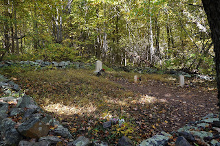
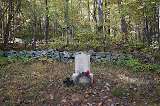
After a fairly straight trek, the trail takes a sharp bend to the right and you find yourself at the cemetery.


 That small black metal cross on the left signifies a Confederate Civil War veteran.

Tuesday, October 06, 2015

Hiking, Part 31


Copyright © 2015
by Ralph F. Couey

Autumn is my favorite time of year, and October is for me the best month.  Regular readers of this blog are undoubtedly heartily sick of reading those words, but repetition doesn't make them less true.

Today was a gorgeous picture-perfect early fall day. The sun, after a solid week of clouds, wind, and rain made a return appearance and brought with it a soul-satisfying 70 degrees.  My wife and I had intended to hike together, but a last-minute obligation kept her otherwise occupied.  She asked me to stay fairly close, so I made the short trip down the road to the Manassas Battlefield National Park.  The park contains some 5,000 unsullied acres preserving the sites of the first two major Civil War Battles in 1861 and 1862.  There are two trails, one of them a 5.5 mile loop on the east side of Sudley Road, and the other a 6.5 mile loop on the other side.  The character of the topography has been preserved, and where there were woods and fields in 1861/1862, woods and fields remain today, one of the best preserved of the battlefields from that war.  The two trails are loops, and if I had to return home early, there was the ability to cut cross-country back to the parking lot.

I arrived mid-morning, and the air which had been distinctly chilly had begun to warm nicely.  The sun's angle was notably lower in the sky, even as noontime approached and those low slanting rays gave the light that distinctive autumn feel.  The grass had begun to acquire that tawny look that so characterizes this time of year and while the leaves are still largely green, there were isolated patches of color to catch the eye.

Saturday, October 03, 2015

Life and Disaster

Joaquin stalkin' across the Caribbean
© 2015 NOAA


It looked like it would be an interesting week. Last Monday, two rather grim forecasts began to approach a disturbing symmetry. First, an epic Nor'easter, one of those legendary Atlantic coast storms, would slam into the local area bringing tropical rainfall, high winds and certain flooding. Then, the day after, a full-fledged hurricane, at one point a vicious Cat 4, would storm ashore, making landfall right over the nation's capitol region. And after the Nor'easter's 6 to 10 inches of rain, the hurricane would dump an additional 10 to 20 inches along with a 10-foot storm surge into the Chesapeake, up the Potomac River, and into downtown Washington DC. Historic communities like Georgetown and Alexandria, cities with an almost 300-year history, would be inundated and destroyed. Freeways, bridges, roads, and the Metro light rail would be washed away, effectively paralyzing the entire region. Government would be forced into Continuity of Operations mode, shifting control and authority to remote scattered classified sites. First responders, overwhelmed by the disaster, would require the military to regain and maintain control. Hundreds of thousands would be made homeless; hundreds would die. The entire area would never be the same

No, this wasn't the script for a new disaster movie. This was the actual forecast faced by the six million people who live in the DMV, local shorthand for DC, Maryland, and Virginia.

But as time unfolded, both events turned out to be pretty much a local fizzle. The Nor'easter was far milder than forecasted. Don't get me wrong, we still got a ton of rain, up to 6 inches in some places, and pretty good winds. Trees were knocked down, some power was lost in the region, and there was some road damage. The beach areas along the Eastern Shore were beat up some and shoreside communities had some flooding. The hurricane, responding to a couple of pressure systems in the atmosphere, peeled off to the northeast and is headed steadily into the colder waters of the North Atlantic where it will meet its eventual demise.

All things considered, we were lucky. Some areas in the Carolinas took up to 11 inches of rain from those systems, and a lot of damage was done there. But it could have been much, much worse.