
The Potomac River Near Harper's Ferry from Weverton Cliff

Copyright © 2014 by Ralph F. Couey
Pictures and written content
I managed to free up a few hours today and went to a location that has been on my anticipation list.
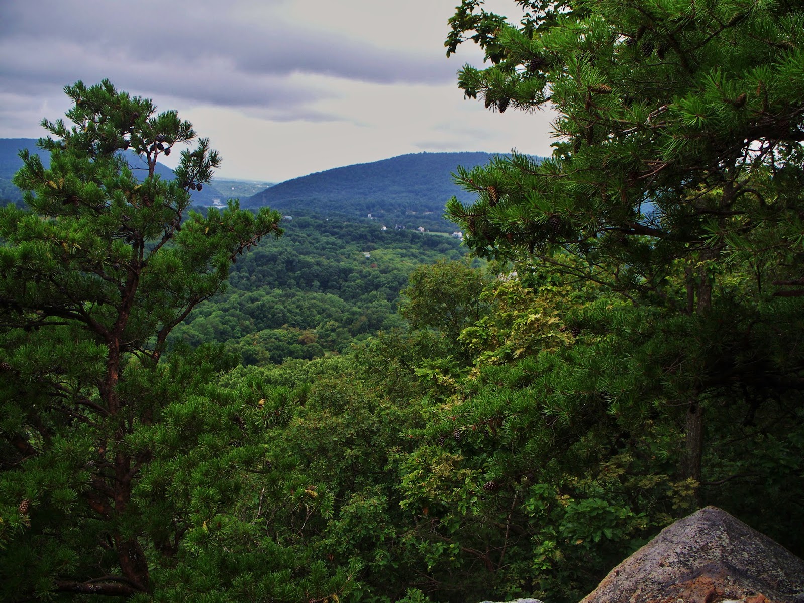
Harper's Ferry, West Virginia is one of those places where history rises from the dry pages of textbook into dazzling reality. The town sits at the confluence of the Potomac and Shenandoah Rivers and was from its beginnings a busy location for river commerce and industry. Today, the National Parks Service has preserved the historical part of the town in an interactive historic park. The town would, by itself, be a very interesting visit, but the view of the two rivers from the point of land where they meet is breathtaking.
The AT (Appalachian Trail) passes through the town, in fact the Conservancy has an office there. From there, you can trek southwards along the crest of Short Hill Mountain as it meanders towards Shenandoah National Park. I chose to go northwards today.
I left my vehicle in the Park n' Ride lot near Weverton and was able to jump right on the trail, as it passes right behind the lot. Having consulted the topo map, I knew I was in for a challenge. South Mountain begins on the north bank of the Potomac and rises precipitately to nearly 1,200 feet. The initial climb is a series of switchbacks as the trail ascends about 600 feet in the first half-mile. It's not just the steep climb that makes this one so challenging. The path is well strewn with rocks which requires careful consideration as to where to plant one's foot. Fortunately, I remembered my trekking poles this time. There were three occasions when I stumbled, slipped, and tripped on the rocks. Only those poles kept me from executing an epic face-plant.


At about 900 feet elevation, the way began to flatten out, but the rocks were still there. It seems as if that end of the mountain is slowly falling apart, dumping rocks down the slopes ranging from pocket-sized to house-sized. I saw several places where the dedicated volunteers had cleared some good sized rock slides from the trail. This climb took me awhile, about an hour and 15 minutes, but once I got to the 1,200 foot level, the trail became a lovely, soft springy loam that felt really great on the feet. I encountered two other hikers, both male, who were fully geared up, their packs topped by foam bed pads. I don't know if they were through hiking or just spending a night or two, but it was nice to see other people out doing the trail.
When you get near the top of the ridge, there is an overlook called Weverton Cliff that provides a lung-sucking panorama of the rivers and the town below.

Yup. I clumb it.

The day was very humid, but not extremely hot, so while I shed a couple of gallons of sweat, I never felt dangerously overheated. I did take the opportunity to try out a couple of new items. One was a belt-mounted device from the OFF company, which sprayed a fine mist of insect repellent into the air while I was walking. It seemed to work pretty well. The bugs would get close to my face, but never touch it, and I survived the day without a single insect bite, and it was a very buggy day. The other thing was a huge floppy bucket hat that I found at Costco. Kind of odd-looking, the brim was large and oval shaped, so it gave good coverage of my face and the back of my neck. Partway uphill though, I had to flip the front brim up, as I found it difficult to see ahead of me. The other think I liked was how well it kept the sweat out of my eyes. Ballcaps (my usual choice) do a fairly good job, but this hat, as ugly as it looks was way more effective. And had I been caught out in the rain, it would have kept my face and eyes clear.

Not quite Indiana Jones...
Finally, the clouds parted and the forest began to be dappled in sun and leaves. I was now on the loamy part of the trail and my pace picked up considerably. My original intent was to do the round trip from Weverton up to the gap just west of Burkittsville, but I got about three miles along this trail and, alas, it was time to turn around. Heading back was a bit easier, although I still had to slow down for the rocky part of the trail.
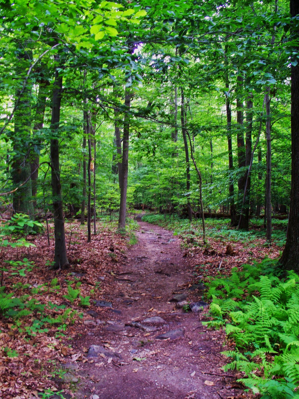
Loamy...

...and lumpy.

Once I passed the sub trail for the cliff, the way became steep again. I was oh, so careful going down, and this was when I had two of my near-face plants. I can't stress enough how important (to me, anyway) these carbon fiber sticks from the Black Diamond company were today. I've had a few tumbles on other trails, but going down on this trek would have resulted in some serious injuries. Some of the switchback corners were partially washed out and the loose rocks were responsible for some unwanted cardiac stimulation. But I managed to get all the way down and finally, footsore and soaking wet, returned to the parking lot.
This was a good example of underestimating the climb. Having ascended the hills at Sky Meadows, I breezily assumed that this one would not present too much of a challenge. Not so. If I ever get a full day to do South Mountain, I need to plan the 13-mile out-and-back a little more carefully.
Humid day, but still a good hike, and another small section of the AT goes in the books.
No comments:
Post a Comment